
")
")

Viewing Economics (1 - 6 of 6)
-
 QGIS standalone
QGIS is a user friendly Open Source Geographic Information System (GIS) licensed under the GNU General Public License. QGIS is an official project of the Open Source Geospatial Foundation (OSGeo). It runs on Linux, Unix, Mac OSX, Windows and Android and supports numerous vector, raster, and database formats and functionalities.
PLN1.00 -
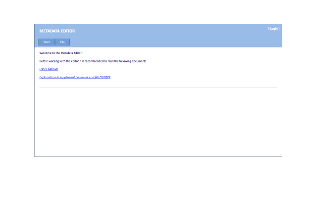 Metadata Editor
Metadata Editor application is a web application whose main task is to enable the user to create, edit metadata files, and manage existing files. In addition, the user can validate file in the adopted metadata profile and publish metadata in the metadata catalog.Supported functions are available through a graphical interface accessible from a web browser.
The new tool builds on the previous version of the metadata editor EGiB. The new version supports three general metadata profiles PZGiK, INSPIRE and ISO and several industry profiles including ORTHO, BMT, EMUiA, EGiB, imaging.
Members of the new Metadata Editor are provided:
- Public access to the tools, without having to log - if you do not create metadata published in the metadata catalog Geoportal
- Tool thin clients available online
- Integration with directory server Geoportal
- Support for ISO and INSPIRE and national technical guidelines in the field of metadata
The application is available at website: http://edytor.geoportal.gov.pl/edytormetadanych/ while providing the functionality of an authorized user is suspended until the completion of work related to the full integration of the Metadata Editor, the directory server under the contract to implement.
Validator data is available via two interfaces:
- Graphical User Interface - Graphical User Interface (GUI) http://walidator.geoportal.gov.pl/walidatormetadanych
- Interface WPS - Web Processing Service http://walidator.geoportal.gov.pl/WPSValidator/WPSValidatorService.svc
PLN0.00 -
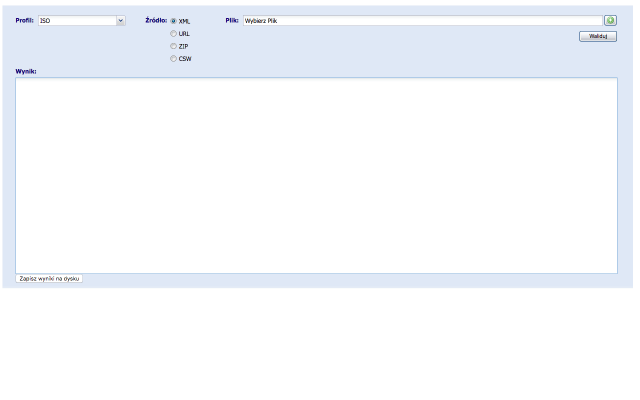 Metadata Validator
The basic functionality expected from the Metadata Validator is a verification file metadata standards and regulations.Taking into account the requirements to ensure compliance with the standards ISO 19100 series as a model for the field of the underlying functionality of the validator are diagrams application metadata defined in the following standards:EN ISO 19115: 2005
- EN ISO 19119: 2006
- ISO / TS 19139: 2007
- INSPIRE Implementing Rules: Version 1.2
- The national technical guidelines in the field of metadata
These standards define the metadata elements that should or can be used to describe data and spatial services. Metadata Validator is a web application available to the public for all users. The result is a validation report, which assesses XML file. It contains a summary of the result of the validation, ie. Whether the file is compatible / incompatible with the selected profile metadata. Returns information on possible errors, along with the location of their occurrence in the file (metadata element).
- Access via two interfaces:
- Graphical User Interface - Graphical User Interface (GUI) http://walidator.geoportal.gov.pl/walidatormetadanych
- Interface WPS - Web Processing Service http://walidator.geoportal.gov.pl/WPSValidator/WPSValidatorService.svc
PLN1.00 -
 Aplikacje rolnicze
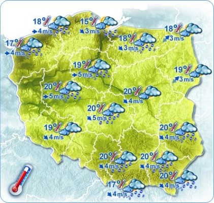
Prognozy meteo
OPIS: Prognoza meteo na kilka dni oprócz podstawowych danych takich jak temp. powietrza, prędkość wiatru i kierunek, ciśnienie, rodzaj opadu i wysokość opadu,uwzględnia także temperaturę powierzchni gruntu, wilgotność, wilgotność właściwą gleby, temperaturę gleby na głębokości 6, 18, 54 i 162 cm.
Przykłady:
PLN0.00 -
WinGIS Lumen 1 month Demoversion
WinGIS Lumen -control the growth from your desk
The European Space Agency (ESA) has provided free and open access to Sentinel satellite data. Sentinel / Copernicus is an earth observation program operated by a partnership of the European Commission (EC), European Space Agency (ESA), and the European Environment Agency (EEA). The SENTINEL collaborative ground segment is intended to allow complementary access to SENTINEL data and/or to specific data products or distribution channels. It is composed of elements funded by third parties (i.e. from outside the ESA/EU Copernicus program) and provides the framework for international cooperation. The collaborative elements are expected to bring specialized solutions to further enhance the SENTINEL missions’ exploitation in various areas.
SENTINEL satellite data need to get professional interpretation. PROGIS has developed a new innovative and cost-effective specialized solution for deriving agrimetry from space for agriculture requirements. With this method, PROGIS can generate agri-metric maps, based on its powerful spatial engine WinGIS, covering single farms, groups of farms or regions or really large areas by simultaneously using differential spectral bands from satellite.
The results provide to agricultural and natural resource management companies with valuable information suitable for planning, seeding, harvesting and exploration. Within an updated cycle of 5-10 days worldwide, the performance is controlled virtually in real time - for every field on the globe from your desk.
If you are interrested for a full working 1 month demo version please send a short mail to office@progis.com
PLN0.00 -
 Pesticides recommender
The pesticides recommender is a prototype (proof of concept) service that wraps the domain knowledge and SWRL rules stored in a Pesticides ontology and provides the mechanism for giving recommendations of products appropriate for the specified situation.
PLN0.00
- Ratings (0)
- Calculations (0)
- Analyses (3)
- Agricultural Accounting (0)
- Farm Management (3)
- Damage Estimating (0)