
")
")

Viewing Farm Management (1 - 15 of 19)
-
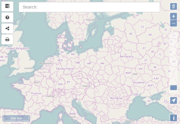 Eurostat
Another one map service!
PLN0.00 -
 Maplog
On-line map service
PLN1.00 -
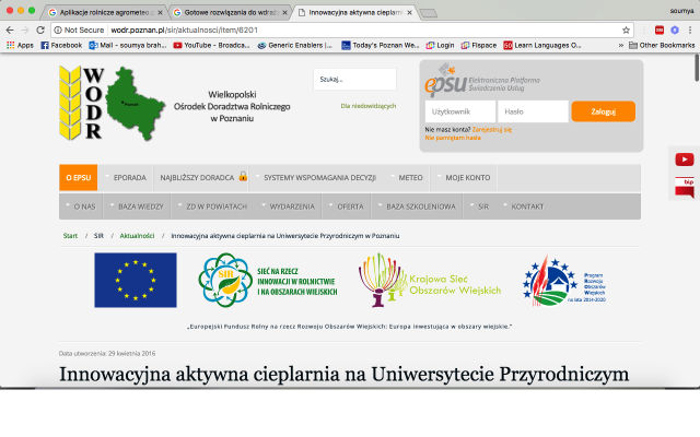 Gotowe rozwiązania do wdrażania i wykorzystania
Rozwiązania sprzętowe i systemowe mogące usprawnić pracę i zarządzanie.
http://wodr.poznan.pl/sir/aktualnosci/item/6201-in...PLN0.00 -
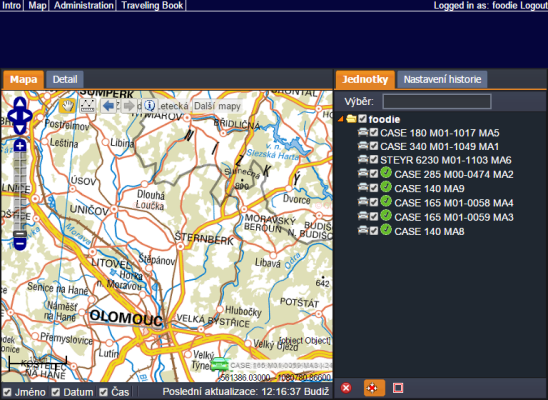
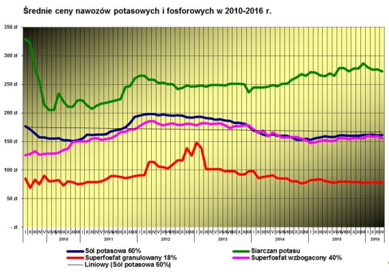 Zarządzanie gospodarstwem rolnym
Zarządzanie gospodarstwem rolnym, aktualna sytuacja cen nawozów w województwie wielkopolskim
http://www.wodr.poznan.pl/baza-informacyjna/ekonomika/zarzdzanie-gospodarstwem-rolnym/item/6417-aktualna-sytuacja-cen-nawozow-w-wojewodztwie-wielkopolskimPLN0.00 - New!
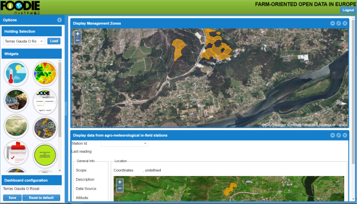 SmartV - Precision Viticulture Dashboard
SmartV is a web-based solution that provides advisory services in different aspects related to winegrowing, like disease prevention, production estimation or harvesting schedule. The cloud infrastructure allows to provide the best service (available everywhere, no installation needed, always updated…). Its user-friendly design allows the winegrowers to apply precision viticulture techniques to manage the variability of the vineyard. It also stores historical information about the status of the vineyard, and the actions carried out to exploit it in a future to get the best results. We provide a unique solution for the farmers, where they can get all the functionalities needed for the proper management of the vineyard.
PLN0.00 -
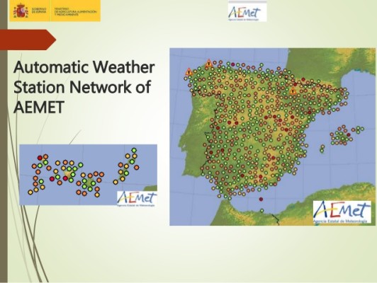 Meteorological Stations of AEMET
List of weather stations of AEMET (Spain's meteorological agency), including an identifier, name, EPSG4326 coordinates and elevation in metres.
PLN0.00 -
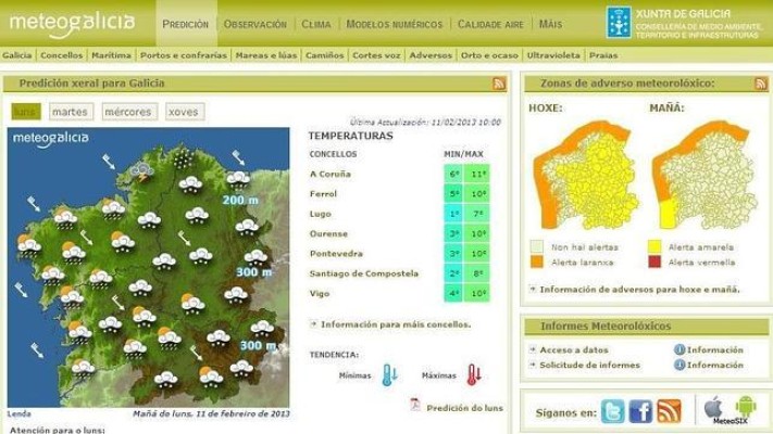 Meteorological Stations of MeteoGalicia
List of weather stations of METEOGALICIA (regional meteorological agency for Galicia), including an identifier, name, EPSG4326 coordinates and elevation in metres.
PLN0.00 -
Meteogalicia_AS_EIRAS_Data
Meteorological data from the weather station of As Eiras, in the province of La Coruña, in the region of Galicia (Spain). The information goes from January, the first, of 2004 to September, the ninth, of 2015.
PLN0.00 -
WinGIS Lumen 1 month Demoversion
WinGIS Lumen -control the growth from your desk
The European Space Agency (ESA) has provided free and open access to Sentinel satellite data. Sentinel / Copernicus is an earth observation program operated by a partnership of the European Commission (EC), European Space Agency (ESA), and the European Environment Agency (EEA). The SENTINEL collaborative ground segment is intended to allow complementary access to SENTINEL data and/or to specific data products or distribution channels. It is composed of elements funded by third parties (i.e. from outside the ESA/EU Copernicus program) and provides the framework for international cooperation. The collaborative elements are expected to bring specialized solutions to further enhance the SENTINEL missions’ exploitation in various areas.
SENTINEL satellite data need to get professional interpretation. PROGIS has developed a new innovative and cost-effective specialized solution for deriving agrimetry from space for agriculture requirements. With this method, PROGIS can generate agri-metric maps, based on its powerful spatial engine WinGIS, covering single farms, groups of farms or regions or really large areas by simultaneously using differential spectral bands from satellite.
The results provide to agricultural and natural resource management companies with valuable information suitable for planning, seeding, harvesting and exploration. Within an updated cycle of 5-10 days worldwide, the performance is controlled virtually in real time - for every field on the globe from your desk.
If you are interrested for a full working 1 month demo version please send a short mail to office@progis.com
PLN0.00 -
 Aplikacje rolnicze
Prognozy meteo
OPIS: Prognoza meteo na kilka dni oprócz podstawowych danych takich jak temp. powietrza, prędkość wiatru i kierunek, ciśnienie, rodzaj opadu i wysokość opadu,uwzględnia także temperaturę powierzchni gruntu, wilgotność, wilgotność właściwą gleby, temperaturę gleby na głębokości 6, 18, 54 i 162 cm.
Przykłady:
PLN0.00 -
 Giełda
Giełda rolna i towarowa
Dane giełdowe – platforma skierowana do producentów rolnych i firm działających na rynku rolno-spożywczym. Platforma jest internetowym sposobem komunikowania się sprzedających i kupujących oraz obrotu produktami rolnymi z wykorzystaniem internetowych ogłoszeń rolniczych w kategoriach m.in. produkcją roślinna, produkcja zwierzęca, maszyny rolnicze, wyposażenie, nieruchomości, opakowania, odzież, praca nawozy, środki ochrony roślin.
Przykładowe linki do giełdy rolnej:
- Internetowa Giełda Rolna i Towarowa, https://www.igrit.pl/
- Gieldarolna.pl, http://www.gieldarolna.pl/
- Rolpetrol Giełda rolno-Paliwowa, http://www.rolpetrol.com.pl/
PLN0.00 -
 Decision Support System (DSS) for the potato and tomato late blight disease (USA)
The Potato/Tomato Late Blight Decision Support System (DSS) is a late blight forecast tool for United States. It enables to use weather (including farm-specific National Weather Service forecasts) to predict the need for future fungicide applications to control late blight.
PLN0.00 -
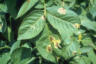
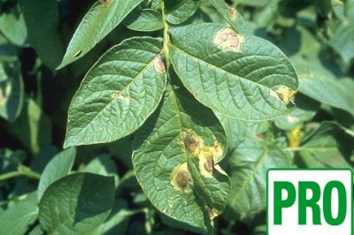 Potato late blight Decision Support System (DSS) PRO (Poland)
Decision Support System for potato late blight for Wielkopolska region in Poland, providing advanced information
PLN1.00 -
 Potato late blight Decision Support System (DSS) (Poland)
Decision Support System for potato late blight for Wielkopolska region in Poland, providing basic information
PLN0.00 -
 Course on technological solution for software components and tools of Farm Management
This course is on the technological solutions for the software components and tools of Farm Management. The tutorials available are as follows:
- Mobile Applications
- APIs Design
PLN1.00
(no subcategories)