
")
")

Viewing All (16 - 30 of 62)
-
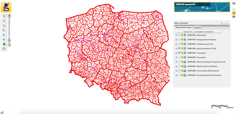 INSPIRE Geoportal
The web application enables viewing of spatial data and search sets and spatial data services provided under the INSPIRE directive.The spatial data themes, the implementation of which is the responsibility of the Surveyor General Land are grouped according to the INSPIRE Directive in three thematic groups
PLN0.00 -
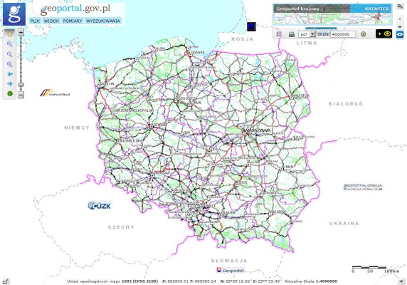 National Geoportal
The web application enables viewing of spatial data and search sets and spatial data services belonging to the National Spatial Data Infrastructure. The data published on the National Geoportals are stored in the state geodetic and cartographic. The content of the National Geoportal maps consists of primarily 12 layers.
PLN1.00 -
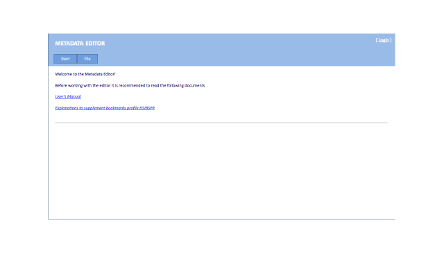 Metadata Editor
Metadata Editor application is a web application whose main task is to enable the user to create, edit metadata files, and manage existing files. In addition, the user can validate file in the adopted metadata profile and publish metadata in the metadata catalog.Supported functions are available through a graphical interface accessible from a web browser.
The new tool builds on the previous version of the metadata editor EGiB. The new version supports three general metadata profiles PZGiK, INSPIRE and ISO and several industry profiles including ORTHO, BMT, EMUiA, EGiB, imaging.
Members of the new Metadata Editor are provided:
- Public access to the tools, without having to log - if you do not create metadata published in the metadata catalog Geoportal
- Tool thin clients available online
- Integration with directory server Geoportal
- Support for ISO and INSPIRE and national technical guidelines in the field of metadata
The application is available at website: http://edytor.geoportal.gov.pl/edytormetadanych/ while providing the functionality of an authorized user is suspended until the completion of work related to the full integration of the Metadata Editor, the directory server under the contract to implement.
Validator data is available via two interfaces:
- Graphical User Interface - Graphical User Interface (GUI) http://walidator.geoportal.gov.pl/walidatormetadanych
- Interface WPS - Web Processing Service http://walidator.geoportal.gov.pl/WPSValidator/WPSValidatorService.svc
PLN0.00 -
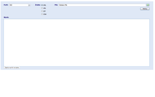 Metadata Validator
The basic functionality expected from the Metadata Validator is a verification file metadata standards and regulations.Taking into account the requirements to ensure compliance with the standards ISO 19100 series as a model for the field of the underlying functionality of the validator are diagrams application metadata defined in the following standards:EN ISO 19115: 2005
- EN ISO 19119: 2006
- ISO / TS 19139: 2007
- INSPIRE Implementing Rules: Version 1.2
- The national technical guidelines in the field of metadata
These standards define the metadata elements that should or can be used to describe data and spatial services. Metadata Validator is a web application available to the public for all users. The result is a validation report, which assesses XML file. It contains a summary of the result of the validation, ie. Whether the file is compatible / incompatible with the selected profile metadata. Returns information on possible errors, along with the location of their occurrence in the file (metadata element).
- Access via two interfaces:
- Graphical User Interface - Graphical User Interface (GUI) http://walidator.geoportal.gov.pl/walidatormetadanych
- Interface WPS - Web Processing Service http://walidator.geoportal.gov.pl/WPSValidator/WPSValidatorService.svc
PLN1.00 -
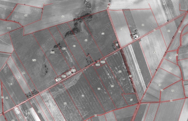 The cadastral data for Poland
According to the "Law of 18 December 2003. On the national register of producers, records of farms and records of applications for payment", the Agency for Restructuring and Modernisation of Agriculture (ARMA), establish and maintain a national registration system of producers, records of farms and records requests for payment.
One of the components of the national system is the Land Parcel Identification System LPIS. The Agency for Restructuring and Modernisation of Agriculture provides the cadastral data in the form of a WMS service to the Polish territory , with the exception of some of the larger cities such. Warsaw, Krakow (approx. 99% of the country).
Shared layer contains information on the approximate boundaries of the parcels, but they can be used only in terms of the approximate identification and spatial localization of the plot and estimate its surface.
These data are the data register of land and buildings in the meaning of the "Regulation of the Minister of Regional Development and Construction of 29 March 2001. on land and buildings.
PLN0.00 -
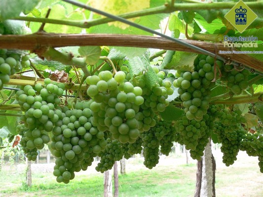
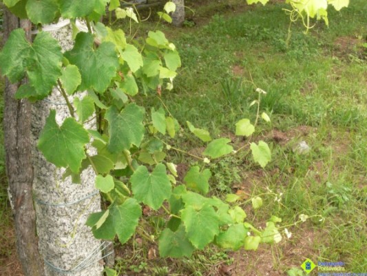
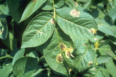
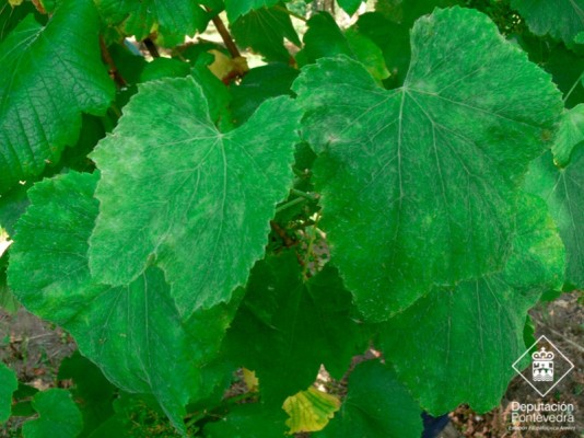 Phytosanitary alerts by the Regional Government of Galicia regarding dangerous pests, or adverse meteorological conditions affecting vineyards on date 14.08.2015
Phytosanitary alerts by the Regional Government of Galicia regarding dangerous pests, or adverse meteorological conditions affecting vineyards on date 14.08.2015.
Particular diseases covered in this bulletin include potato late blight and others.
PLN0.00 -
 Phytosanitary alerts by the Regional Government of Galicia regarding dangerous pests, or adverse meteorological conditions affecting vineyards on date 7.08.2015
Phytosanitary alerts by the Regional Government of Galicia regarding dangerous pests, or adverse meteorological conditions affecting vineyards on date 7.08.2015.
PLN1.00 -
 Phytosanitary alerts by the Regional Government of Galicia regarding dangerous pests, or adverse meteorological conditions affecting vineyards on date 31.07.2015
Phytosanitary alerts by the Regional Government of Galicia regarding dangerous pests, or adverse meteorological conditions affecting vineyards on date 31.07.2015.
PLN0.00 -
 Phytosanitary alerts by the Regional Government of Galicia regarding dangerous pests, or adverse meteorological conditions affecting vineyards on date 24.07.2015
Phytosanitary alerts by the Regional Government of Galicia regarding dangerous pests, or adverse meteorological conditions affecting vineyards on date 24.07.2015.
PLN1.00 -
 Course for Production Methods
The methods described in the course include: (note that potato late blight and other plant diseases are also discussed)
- Sustainable production
- Precision farming
- Precision viticulture
PLN0.00 -
Course for Management Methods
This course in on management methods regarding farm management. The methods covered in this course include:
- Knowledge Management: relationship between people, processes and technology systems involved in designing, capturing and implementing the intellectual infrastructure of an organisation. I
- Logistic: transport of products to and from the farm as to and from the field including all the use of machinery involved in using seeds, fertilizer, pesticides to harvest the results from the fields.
- Tactical Planning: recommend optimal production and land use for next seasons to maximize the expected profit.
PLN1.00 -
Course for Market Analysis for farm managementMarket knowledge is of primary importance for making any production plans or sales. The provision of reliable information related to the economic dynamics, market’s needs, crop forecast, seed prices, costs of inputs (such as fuel and fertilizer), agri-chemicals, micro-ingredients, transport and processing, farm machinery, total industry value, labour indicators and commodity market value is a key component in managing agri-business strategically . Therefore, an overview about the market trends empower farmers to make well-informed decisions as well as effectively respond to new arising situations.
This is covering Wielkopolska region in Poland and for the potato late blight in crops
PLN1.00 -
Course on Data for Software Components and tools of Farm Management
This course is on the source of data and data management used for the software components and tools of Farm Management. The tutorials available are as follows:
- Data management (Map data and Marketplace)
- Data Visualization (Widgets and Mashup )
- Data Fusion (methods)
PLN1.00 -
Course on technological solution for software components and tools of Farm Management
This course is on the technological solutions for the software components and tools of Farm Management. The tutorials available are as follows:
- Mobile Applications
- APIs Design
PLN1.00 -
 Potato late blight Decision Support System (DSS) (Poland)
Decision Support System for potato late blight for Wielkopolska region in Poland, providing basic information
PLN0.00
- Economics (34)
- Environment (1)
- Rural Development (13)
- Production Technology (5)
- EU And Domestic Help (9)