
")
")

Viewing All (1 - 15 of 62)
-
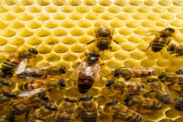 Zdrowotność pszczół – postępowanie przy zwalczaniu zgnilca amerykańskiego
Produkcja zwierzęca, Zdrowotność pszczół – postępowanie przy zwalczaniu zgnilca amerykańskiego
http://www.wodr.poznan.pl/baza-informacyjna/technologia/produkcja-zwierzca/pszczoly/hodowla-pszczol/item/6041-zdrowotnosc-pszczol-postepowanie-przy-zwalczaniu-zgnilca-amerykanskiegoPLN0.00 -
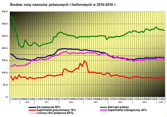 Zarządzanie gospodarstwem rolnym
Zarządzanie gospodarstwem rolnym, aktualna sytuacja cen nawozów w województwie wielkopolskim
http://www.wodr.poznan.pl/baza-informacyjna/ekonomika/zarzdzanie-gospodarstwem-rolnym/item/6417-aktualna-sytuacja-cen-nawozow-w-wojewodztwie-wielkopolskimPLN0.00 -
 World Agricultural Supply and Demand Report
World Agricultural Supply and Demand Report
PLN0.00 -
WinGIS Lumen 1 month Demoversion
WinGIS Lumen -control the growth from your desk
The European Space Agency (ESA) has provided free and open access to Sentinel satellite data. Sentinel / Copernicus is an earth observation program operated by a partnership of the European Commission (EC), European Space Agency (ESA), and the European Environment Agency (EEA). The SENTINEL collaborative ground segment is intended to allow complementary access to SENTINEL data and/or to specific data products or distribution channels. It is composed of elements funded by third parties (i.e. from outside the ESA/EU Copernicus program) and provides the framework for international cooperation. The collaborative elements are expected to bring specialized solutions to further enhance the SENTINEL missions’ exploitation in various areas.
SENTINEL satellite data need to get professional interpretation. PROGIS has developed a new innovative and cost-effective specialized solution for deriving agrimetry from space for agriculture requirements. With this method, PROGIS can generate agri-metric maps, based on its powerful spatial engine WinGIS, covering single farms, groups of farms or regions or really large areas by simultaneously using differential spectral bands from satellite.
The results provide to agricultural and natural resource management companies with valuable information suitable for planning, seeding, harvesting and exploration. Within an updated cycle of 5-10 days worldwide, the performance is controlled virtually in real time - for every field on the globe from your desk.
If you are interrested for a full working 1 month demo version please send a short mail to office@progis.com
PLN0.00 -
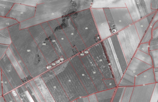 The cadastral data for Poland
According to the "Law of 18 December 2003. On the national register of producers, records of farms and records of applications for payment", the Agency for Restructuring and Modernisation of Agriculture (ARMA), establish and maintain a national registration system of producers, records of farms and records requests for payment.
One of the components of the national system is the Land Parcel Identification System LPIS. The Agency for Restructuring and Modernisation of Agriculture provides the cadastral data in the form of a WMS service to the Polish territory , with the exception of some of the larger cities such. Warsaw, Krakow (approx. 99% of the country).
Shared layer contains information on the approximate boundaries of the parcels, but they can be used only in terms of the approximate identification and spatial localization of the plot and estimate its surface.
These data are the data register of land and buildings in the meaning of the "Regulation of the Minister of Regional Development and Construction of 29 March 2001. on land and buildings.
PLN0.00 -
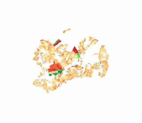 Sowing plots for the Tršice area, Czech Republic, in 2015
Sowing plots of the Tršice area (49.543749, 17.424639) that are being cultivated by the MJM company in 2015. The database contains the identification of the crop species, its coverage, steepness of a plot or a link to a relevant farmer's block from the Czech Land Parcel Identification System (LPIS).
PLN0.00 -
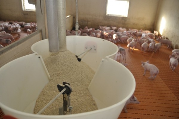 Soja w aspekcie zazieleniania oraz wykorzystania w żywieniu świń
Produkcja zwierzęca, Soja w aspekcie zazieleniania oraz wykorzystania w żywieniu świń
http://www.wodr.poznan.pl/baza-informacyjna/technologia/produkcja-zwierzca/trzoda-chlewna/zywienie/item/5138-soja-w-aspekcie-zazieleniania-oraz-wykorzystania-w-zywieniu-swinPLN0.00 - New!
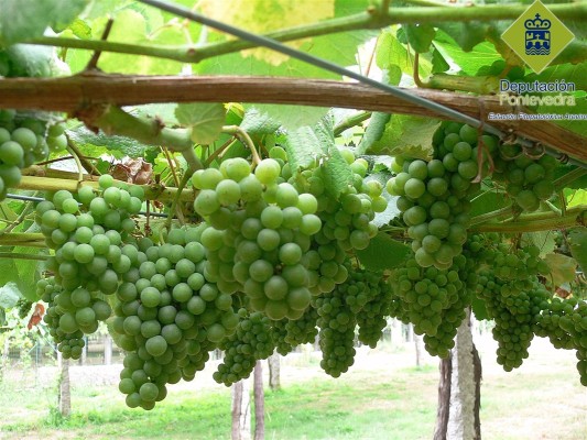
 SmartV - Precision Viticulture Dashboard
SmartV is a web-based solution that provides advisory services in different aspects related to winegrowing, like disease prevention, production estimation or harvesting schedule. The cloud infrastructure allows to provide the best service (available everywhere, no installation needed, always updated…). Its user-friendly design allows the winegrowers to apply precision viticulture techniques to manage the variability of the vineyard. It also stores historical information about the status of the vineyard, and the actions carried out to exploit it in a future to get the best results. We provide a unique solution for the farmers, where they can get all the functionalities needed for the proper management of the vineyard.
PLN0.00 -
 Rolnictwo ekologiczne
Rolnictwo ekologiczne, Rośliny wysokobiałkowe w uprawie ekologicznej
http://www.wodr.poznan.pl/baza-informacyjna/srodowisko/rolnictwo-ekologiczne/item/6062-rosliny-wysokobialkowe-w-uprawie-ekologicznejPLN0.00 -
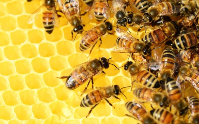 Rodzina i zdrowie
Rodzina i zdrowie, Produkty pszczele stosowane w apiterapii
http://www.wodr.poznan.pl/baza-informacyjna/rozwoj-wsi/grupy-regionalne/item/6211-produkty-pszczele-stosowane-w-apiterapiiPLN0.00 -
 QGIS standalone
QGIS is a user friendly Open Source Geographic Information System (GIS) licensed under the GNU General Public License. QGIS is an official project of the Open Source Geospatial Foundation (OSGeo). It runs on Linux, Unix, Mac OSX, Windows and Android and supports numerous vector, raster, and database formats and functionalities.
PLN1.00 -
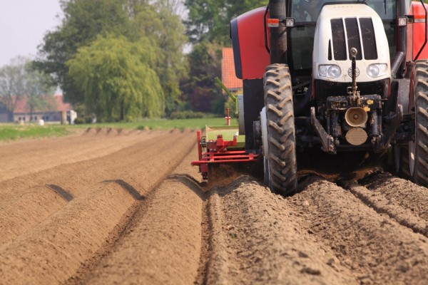 Przygotowanie opryskiwacza na zimę
Produkcja roślinna, Przygotowanie opryskiwacza na zimę
http://www.wodr.poznan.pl/baza-informacyjna/technologia/produkcja-roslinna/item/3262-przygotowanie-opryskiwacza-na-zim%C4%99PLN0.00 -
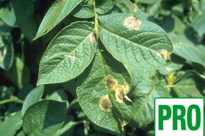 Potato late blight Decision Support System (DSS) PRO (Poland)
Decision Support System for potato late blight for Wielkopolska region in Poland, providing advanced information
PLN1.00 -
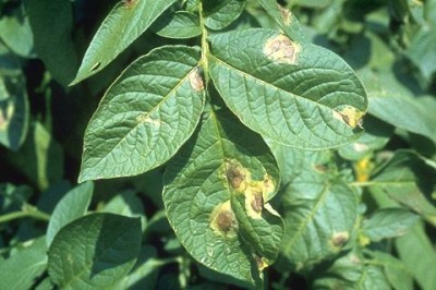 Potato late blight Decision Support System (DSS) (Poland)
Decision Support System for potato late blight for Wielkopolska region in Poland, providing basic information
PLN0.00 -
 Phytosanitary alerts by the Regional Government of Galicia regarding dangerous pests, or adverse meteorological conditions affecting vineyards on date 7.08.2015
Phytosanitary alerts by the Regional Government of Galicia regarding dangerous pests, or adverse meteorological conditions affecting vineyards on date 7.08.2015.
PLN1.00
- Economics (34)
- Environment (1)
- Rural Development (13)
- Production Technology (5)
- EU And Domestic Help (9)