
")
")

Viewing Economics (16 - 30 of 34)
-
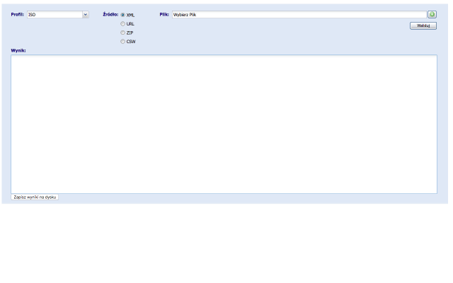 Metadata Validator
The basic functionality expected from the Metadata Validator is a verification file metadata standards and regulations.Taking into account the requirements to ensure compliance with the standards ISO 19100 series as a model for the field of the underlying functionality of the validator are diagrams application metadata defined in the following standards:EN ISO 19115: 2005
- EN ISO 19119: 2006
- ISO / TS 19139: 2007
- INSPIRE Implementing Rules: Version 1.2
- The national technical guidelines in the field of metadata
These standards define the metadata elements that should or can be used to describe data and spatial services. Metadata Validator is a web application available to the public for all users. The result is a validation report, which assesses XML file. It contains a summary of the result of the validation, ie. Whether the file is compatible / incompatible with the selected profile metadata. Returns information on possible errors, along with the location of their occurrence in the file (metadata element).
- Access via two interfaces:
- Graphical User Interface - Graphical User Interface (GUI) http://walidator.geoportal.gov.pl/walidatormetadanych
- Interface WPS - Web Processing Service http://walidator.geoportal.gov.pl/WPSValidator/WPSValidatorService.svc
PLN1.00 -
 Meteogalicia_AS_EIRAS_Data
Meteorological data from the weather station of As Eiras, in the province of La Coruña, in the region of Galicia (Spain). The information goes from January, the first, of 2004 to September, the ninth, of 2015.
PLN0.00 -
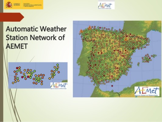 Meteorological Stations of AEMET
List of weather stations of AEMET (Spain's meteorological agency), including an identifier, name, EPSG4326 coordinates and elevation in metres.
PLN0.00 -
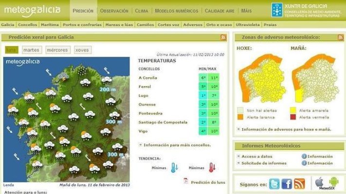
Meteorological Stations of MeteoGalicia
List of weather stations of METEOGALICIA (regional meteorological agency for Galicia), including an identifier, name, EPSG4326 coordinates and elevation in metres.
PLN0.00 -
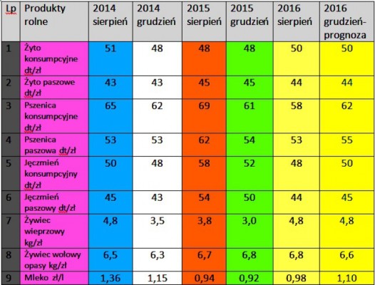 Notowania cen
Notowania cen produktów rolniczych i środków do produkcji na terenie działania WODR w Poznaniu
PLN0.00 -
 Open data from the Czech Land Parcel Identification System in 2015
Evidence of the soil on the level of farmer's blocks in the form of explicit geometry and additional attributes. Such evidence is primarily intended for the verification of the subsidies for a farmer. The additional attributes comprises, among others, identification of the crop species, beginning date of the crop species production, steepness etc. The basic scale was set to 1 : 10 000.
PLN1.00 -
 Parcels Austria (samples)
Cadaster land parcels data from Austria
PLN0.00 -
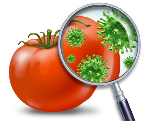 Pesticides recommender
The pesticides recommender is a prototype (proof of concept) service that wraps the domain knowledge and SWRL rules stored in a Pesticides ontology and provides the mechanism for giving recommendations of products appropriate for the specified situation.
PLN0.00 -
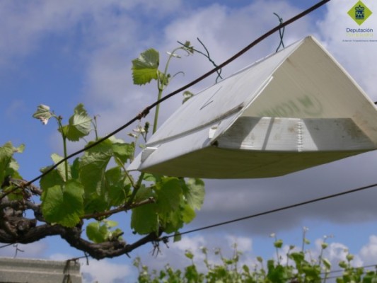 Phytosanitary alert samples by the Regional Government of Galicia (2013-2014) - Part I
Compendium of representative phytosanitary alerts by the Regional Government of Galicia regarding dangerous pests, or adverse meteorological conditions affecting vineyards
PLN0.00 -
.jpg?browse) Phytosanitary alert samples by the Regional Government of Galicia (2013-2014) - Part II
Phytosanitary alert samples by the Regional Government of Galicia (2013-2014) - Part IICompendium of representative phytosanitary alerts by the Regional Government of Galicia regarding dangerous pests, or adverse meteorological conditions affecting vineyards
PLN1.00 -
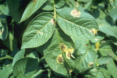 Potato late blight Decision Support System (DSS) (Poland)
Decision Support System for potato late blight for Wielkopolska region in Poland, providing basic information
PLN0.00 -
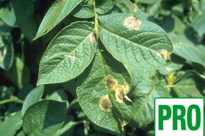 Potato late blight Decision Support System (DSS) PRO (Poland)
Decision Support System for potato late blight for Wielkopolska region in Poland, providing advanced information
PLN1.00 -
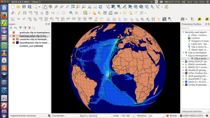
 QGIS standalone
QGIS is a user friendly Open Source Geographic Information System (GIS) licensed under the GNU General Public License. QGIS is an official project of the Open Source Geospatial Foundation (OSGeo). It runs on Linux, Unix, Mac OSX, Windows and Android and supports numerous vector, raster, and database formats and functionalities.
PLN1.00 - New!
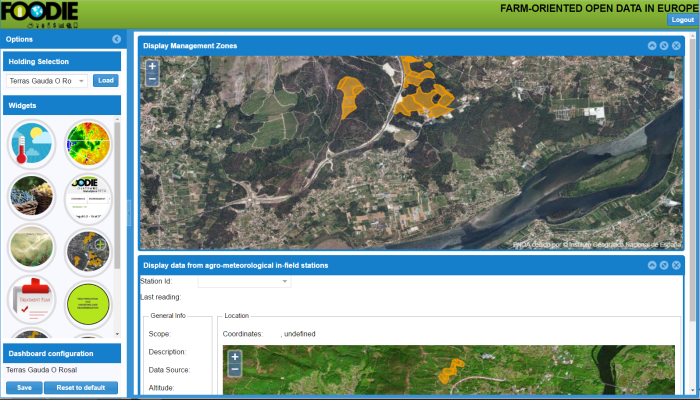 SmartV - Precision Viticulture Dashboard
SmartV is a web-based solution that provides advisory services in different aspects related to winegrowing, like disease prevention, production estimation or harvesting schedule. The cloud infrastructure allows to provide the best service (available everywhere, no installation needed, always updated…). Its user-friendly design allows the winegrowers to apply precision viticulture techniques to manage the variability of the vineyard. It also stores historical information about the status of the vineyard, and the actions carried out to exploit it in a future to get the best results. We provide a unique solution for the farmers, where they can get all the functionalities needed for the proper management of the vineyard.
PLN0.00 -
 Sowing plots for the Tršice area, Czech Republic, in 2015
Sowing plots of the Tršice area (49.543749, 17.424639) that are being cultivated by the MJM company in 2015. The database contains the identification of the crop species, its coverage, steepness of a plot or a link to a relevant farmer's block from the Czech Land Parcel Identification System (LPIS).
PLN0.00
- Ratings (1)
- Calculations (1)
- Analyses (11)
- Agricultural Accounting (0)
- Farm Management (19)
- Damage Estimating (2)