
")
")

Viewing All (1 - 15 of 62)
-
 Maplog
On-line map service
PLN1.00 -
 Orthofotos TIFF
Orthofoto map Austria
Delivery: please expect an email with further instructions.
PLN1.00 -
 Open data from the Czech Land Parcel Identification System in 2015
Evidence of the soil on the level of farmer's blocks in the form of explicit geometry and additional attributes. Such evidence is primarily intended for the verification of the subsidies for a farmer. The additional attributes comprises, among others, identification of the crop species, beginning date of the crop species production, steepness etc. The basic scale was set to 1 : 10 000.
PLN1.00 -
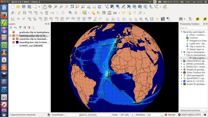
 QGIS standalone
QGIS is a user friendly Open Source Geographic Information System (GIS) licensed under the GNU General Public License. QGIS is an official project of the Open Source Geospatial Foundation (OSGeo). It runs on Linux, Unix, Mac OSX, Windows and Android and supports numerous vector, raster, and database formats and functionalities.
PLN1.00 -
 Agrometeorological Information
Weather and climate conditions have a critical impact on the timing and efficiency of agricultural ordinary actions as planting, irrigating, harvesting. Meteorological variations gauge also the effective-ness of application of inputs as fertilisers, pesticides, insecticides. Furthermore, they determine all cultivation aspects, especially selection of varieties, water management (depending on how much rain is expected) through appropriate irrigation scheduling, inputs saving in terms of electricity and fuel.
PLN1.00 -
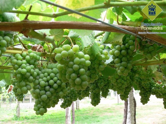
.jpg?browse) Phytosanitary alert samples by the Regional Government of Galicia (2013-2014) - Part II
Phytosanitary alert samples by the Regional Government of Galicia (2013-2014) - Part IICompendium of representative phytosanitary alerts by the Regional Government of Galicia regarding dangerous pests, or adverse meteorological conditions affecting vineyards
PLN1.00 -
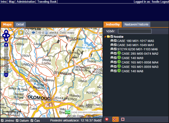
 FOODIE mobile app
End-user mobile applications fulfilling the requirements imposed by the scenarios defined in FOODIE pilots. These applications are obtained by reusing, as much as possible, the FOODIE visualization widgets guaranteeing the appropriate adaptation of the interfaces to mobile devices. These mobile applications present customized user interfaces to facilitate different agents in the agricultural sector (farmers, manufacturers, suppliers, agencies, scientists, etc.) to explore data through different devices and to make appropriate decisions based on the information available
PLN1.00 -
 Phytosanitary alerts by the Regional Government of Galicia regarding dangerous pests, or adverse meteorological conditions affecting vineyards on date 23.12.2015
Phytosanitary alerts by the Regional Government of Galicia regarding dangerous pests, or adverse meteorological conditions affecting vineyards on date 23.12.2015
PLN1.00 -
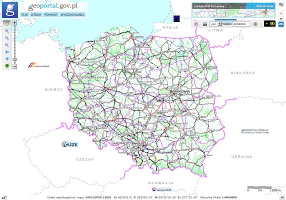 National Geoportal
The web application enables viewing of spatial data and search sets and spatial data services belonging to the National Spatial Data Infrastructure. The data published on the National Geoportals are stored in the state geodetic and cartographic. The content of the National Geoportal maps consists of primarily 12 layers.
PLN1.00 -
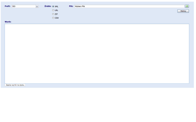 Metadata Validator
The basic functionality expected from the Metadata Validator is a verification file metadata standards and regulations.Taking into account the requirements to ensure compliance with the standards ISO 19100 series as a model for the field of the underlying functionality of the validator are diagrams application metadata defined in the following standards:EN ISO 19115: 2005
- EN ISO 19119: 2006
- ISO / TS 19139: 2007
- INSPIRE Implementing Rules: Version 1.2
- The national technical guidelines in the field of metadata
These standards define the metadata elements that should or can be used to describe data and spatial services. Metadata Validator is a web application available to the public for all users. The result is a validation report, which assesses XML file. It contains a summary of the result of the validation, ie. Whether the file is compatible / incompatible with the selected profile metadata. Returns information on possible errors, along with the location of their occurrence in the file (metadata element).
- Access via two interfaces:
- Graphical User Interface - Graphical User Interface (GUI) http://walidator.geoportal.gov.pl/walidatormetadanych
- Interface WPS - Web Processing Service http://walidator.geoportal.gov.pl/WPSValidator/WPSValidatorService.svc
PLN1.00 -
 Phytosanitary alerts by the Regional Government of Galicia regarding dangerous pests, or adverse meteorological conditions affecting vineyards on date 7.08.2015
Phytosanitary alerts by the Regional Government of Galicia regarding dangerous pests, or adverse meteorological conditions affecting vineyards on date 7.08.2015.
PLN1.00 -
 Phytosanitary alerts by the Regional Government of Galicia regarding dangerous pests, or adverse meteorological conditions affecting vineyards on date 24.07.2015
Phytosanitary alerts by the Regional Government of Galicia regarding dangerous pests, or adverse meteorological conditions affecting vineyards on date 24.07.2015.
PLN1.00 -
 Course for Management Methods
This course in on management methods regarding farm management. The methods covered in this course include:
- Knowledge Management: relationship between people, processes and technology systems involved in designing, capturing and implementing the intellectual infrastructure of an organisation. I
- Logistic: transport of products to and from the farm as to and from the field including all the use of machinery involved in using seeds, fertilizer, pesticides to harvest the results from the fields.
- Tactical Planning: recommend optimal production and land use for next seasons to maximize the expected profit.
PLN1.00 -
Course for Market Analysis for farm managementMarket knowledge is of primary importance for making any production plans or sales. The provision of reliable information related to the economic dynamics, market’s needs, crop forecast, seed prices, costs of inputs (such as fuel and fertilizer), agri-chemicals, micro-ingredients, transport and processing, farm machinery, total industry value, labour indicators and commodity market value is a key component in managing agri-business strategically . Therefore, an overview about the market trends empower farmers to make well-informed decisions as well as effectively respond to new arising situations.
This is covering Wielkopolska region in Poland and for the potato late blight in crops
PLN1.00 -
Course on Data for Software Components and tools of Farm Management
This course is on the source of data and data management used for the software components and tools of Farm Management. The tutorials available are as follows:
- Data management (Map data and Marketplace)
- Data Visualization (Widgets and Mashup )
- Data Fusion (methods)
PLN1.00
- Economics (34)
- Environment (1)
- Rural Development (13)
- Production Technology (5)
- EU And Domestic Help (9)